


ADAMS PCT 03, Butler County, Pennsylvania
About
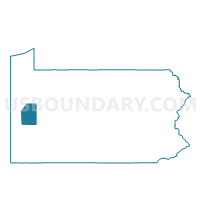
Outline

Summary
| Unique Area Identifier | 657891 |
| Name | ADAMS PCT 03 |
| County | Butler County |
| State | Pennsylvania |
| Area (square miles) | 14.28 |
| Land Area (square miles) | 14.26 |
| Water Area (square miles) | 0.02 |
| % of Land Area | 99.87 |
| % of Water Area | 0.13 |
| Latitude of the Internal Point | 40.70452650 |
| Longtitude of the Internal Point | -79.99066970 |
Maps


Graphs
Select a template below for downloading or customizing gragh for ADAMS PCT 03, Butler County, Pennsylvania


Neighbors
Neighoring Voting District (by Name) Neighboring Voting District on the Map
- ADAMS PCT 01, Butler County, PA
- ADAMS PCT 02, Butler County, PA
- CALLERY Voting District, Butler County, PA
- FORWARD TWP Voting District, Butler County, PA
- MARS Voting District, Butler County, PA
- MIDDLESEX TWP VTD NORTH, Butler County, PA
- MIDDLESEX TWP VTD SOUTH, Butler County, PA
- PENN TWP VTD WEST, Butler County, PA
- PINE TWP DIST 01, Allegheny County, PA
- PINE TWP DIST 02, Allegheny County, PA
- RICHLAND TWP DIST 01, Allegheny County, PA
- VALENCIA Voting District, Butler County, PA
Top 10 Neighboring County Subdivision (by Population) Neighboring County Subdivision on the Map
- Adams township, Butler County, PA (11,652)
- Pine township, Allegheny County, PA (11,497)
- Richland township, Allegheny County, PA (11,100)
- Middlesex township, Butler County, PA (5,390)
- Penn township, Butler County, PA (5,071)
- Forward township, Butler County, PA (2,531)
- Mars borough, Butler County, PA (1,699)
- Valencia borough, Butler County, PA (551)
- Callery borough, Butler County, PA (394)
Top 10 Neighboring Place (by Population) Neighboring Place on the Map
Top 10 Neighboring Unified School District (by Population) Neighboring Unified School District on the Map
- Seneca Valley School District, PA (46,966)
- Pine-Richland School District, PA (22,597)
- Mars Area School District, PA (18,960)
- South Butler County School District, PA (18,499)
Top 10 Neighboring State Legislative District Lower Chamber (by Population) Neighboring State Legislative District Lower Chamber on the Map
Top 10 Neighboring State Legislative District Upper Chamber (by Population) Neighboring State Legislative District Upper Chamber on the Map
Top 10 Neighboring 111th Congressional District (by Population) Neighboring 111th Congressional District on the Map
Top 10 Neighboring Census Tract (by Population) Neighboring Census Tract on the Map
- Census Tract 4090, Allegheny County, PA (11,497)
- Census Tract 9124.01, Butler County, PA (7,813)
- Census Tract 9124.02, Butler County, PA (6,483)
- Census Tract 9128, Butler County, PA (5,390)
- Census Tract 9116, Butler County, PA (5,071)
- Census Tract 4080.01, Allegheny County, PA (4,769)
- Census Tract 9117, Butler County, PA (4,364)
Top 10 Neighboring 5-Digit ZIP Code Tabulation Area (by Population) Neighboring 5-Digit ZIP Code Tabulation Area on the Map
- 15044, PA (27,049)
- 16002, PA (15,877)
- 16046, PA (14,396)
- 16059, PA (7,738)
- 16033, PA (6,165)
- 16024, PA (209)